
Mayon Beyond the Perfect Cone: History and the October 2026 Eruption
Mayon’s October explosion is part of an ongoing eruption. Its history explains why this celebrated Philippine landscape demands attention as well as wonder.
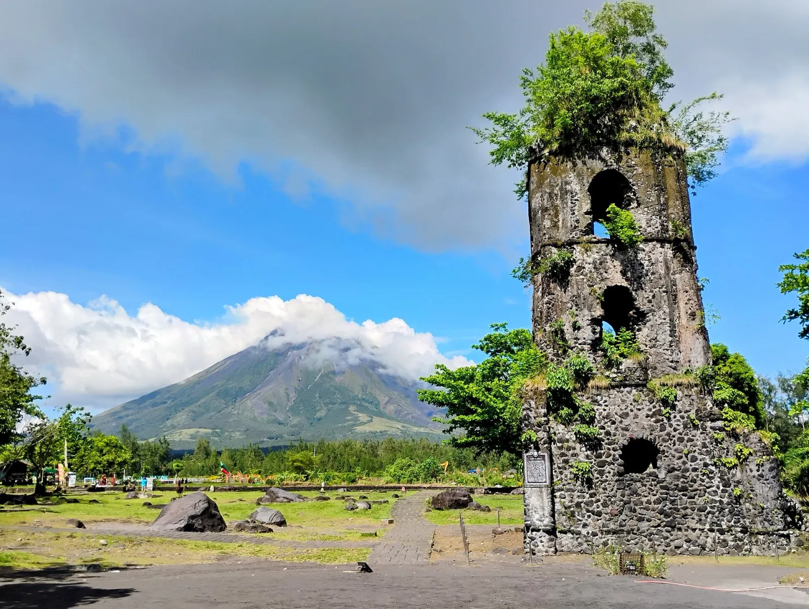
The photograph is almost too orderly: a church tower in the foreground, a volcano rising behind it, the sides of the cone meeting high above the plain. At Cagsawa in Albay, southern Luzon, that composition brings Mayon’s beauty and its destructive history into a single frame.
It is also an image that can mislead when stripped of its date. A peaceful view is not a current safety assessment. Mayon is an active volcano, and the latest official report reviewed for this feature describes renewed explosive activity during an eruption that began earlier in 2026.
The latest eruption: what the November 6 report says
In its 5 a.m. report on November 6, 2026, the Philippine Institute of Volcanology and Seismology, or PHIVOLCS, described a roughly six-minute explosion at 11:53 a.m. on October 30. An ash column rose about three kilometers above the crater. Hot pyroclastic currents traveled approximately 1.5 to two kilometers down the Bonga and Basud gullies; clouds obscured some other areas.
PHIVOLCS raised Mayon to Alert Level 3 on October 30 and maintained that level in the November 6 report. It also recorded ash emission on October 31 and smaller Strombolian episodes on November 2 and 3. Entry into the six-kilometer Permanent Danger Zone remained strictly prohibited. The agency warned about possible hazards beyond that boundary in southern and eastern sectors and about rain-triggered lahars.
Those details describe a dated assessment, not a forecast valid indefinitely. Before making travel decisions, consult PHIVOLCS and the relevant local government for newer instructions, closures and evacuation orders. A point outside a circle on a map is not automatically safe from every volcanic hazard.
One eruption can have several chapters
An eruption does not always consist of one dramatic blast followed by silence. PHIVOLCS’ historical eruption database lists the episode beginning January 6, 2026 as ongoing. Its record also includes a months-long effusive eruption in 2023 and the lava fountaining and flows of early 2018. Different phases can occur within a single episode.
NASA Earth Observatory’s March 2026 account documented the earlier part of the current eruption, including lava movement visible in Landsat imagery acquired on February 26. Its presentation combined ordinary satellite imagery with infrared information to show heat. That is a scientific visualization, not a claim that the landscape looked exactly that way to an observer on the ground.
The distinction matters in the age of recycled eruption clips. A spectacular photograph may be authentic and still be the wrong evidence for today. Check the acquisition date, location and caption before sharing it as breaking news. The photographs accompanying this feature are historical context, not images of the October 30 explosion.
The cone is a record of construction
Mayon rises in Albay in the Bicol region. The Smithsonian Global Volcanism Program identifies it as a stratovolcano with a long record of eruptions. Its shape is the product of volcanic activity, rather than a decorative form somehow separate from it.
Stratovolcanoes accumulate material through repeated eruptions. The U.S. National Park Service’s explanation of composite volcanoes describes how lava and fragmented volcanic deposits build these steep mountains. Their slopes can channel dangerous flows as well as provide the symmetry that draws attention in photographs.
For a traveler, this changes the central question. Instead of asking how close it is possible to get to the cone, ask how the landscape has been formed and how people understand its changing activity. A distant view can reveal more when it is accompanied by a map, a dated bulletin and an explanation of what lies beneath the familiar outline.
Cagsawa: a landscape with a human date
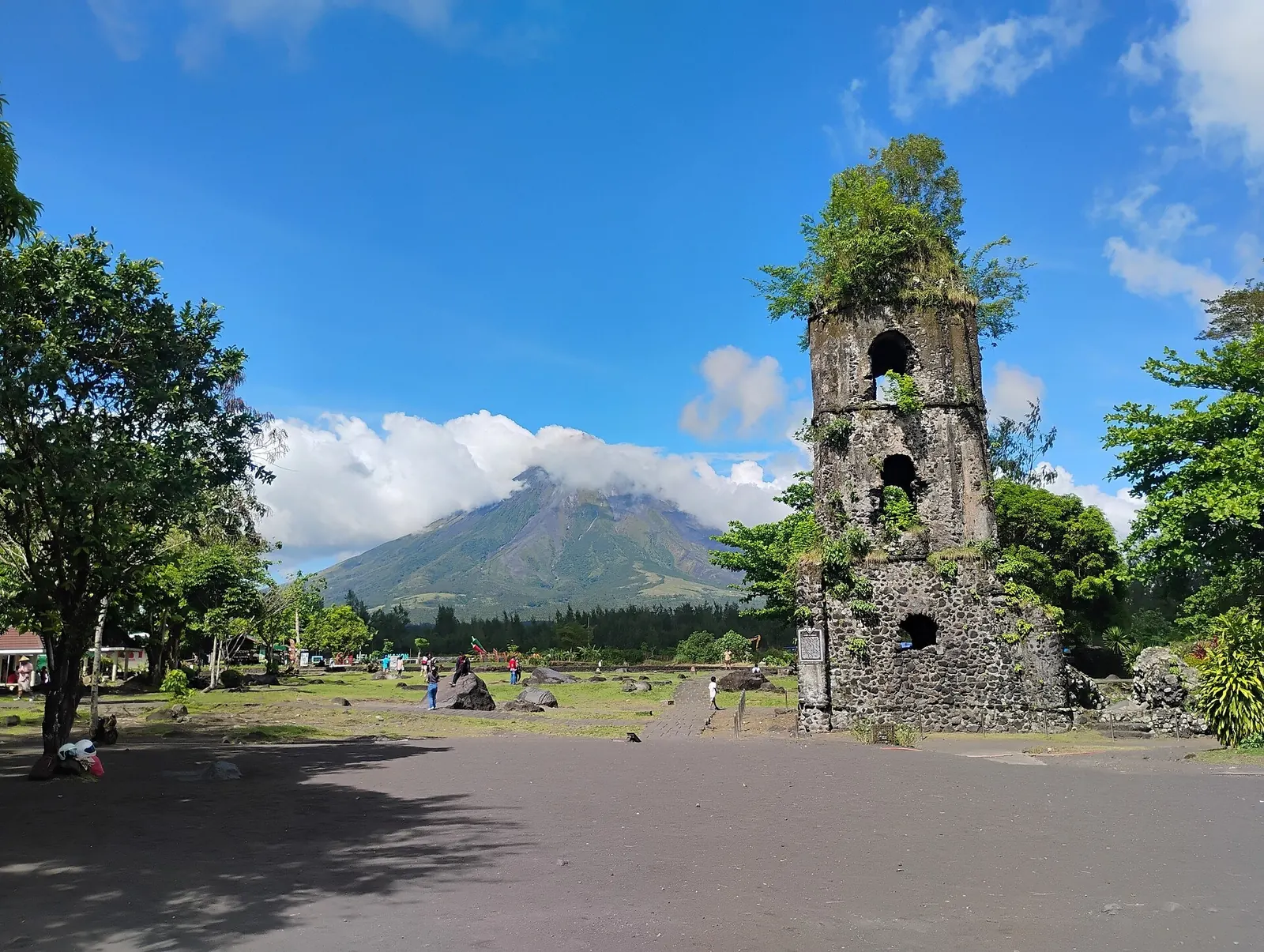
The National Historical Commission’s record of the Cagsawa marker commemorates the destruction of the town on February 1, 1814. The marker records approximately 1,200 deaths and the subsequent decision to relocate the community to Daraga. The number belongs to that commemorative account; it should not be turned into an invented list of people who died inside one particular building.
The surviving ruins make loss visible, but relocation is equally important to the story. An eruption changes more than a skyline. It can force decisions about where to live, worship, work and rebuild. Reading the marker alongside the mountain helps restore those human consequences to a scene often reduced to a postcard.
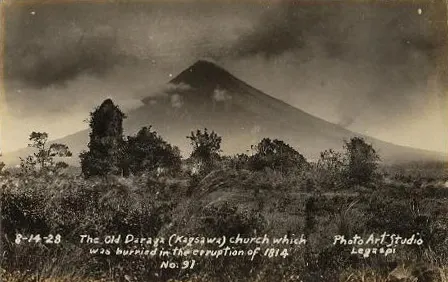
An archival 1928 photograph also shows why ruins should be read historically. Structures that survive into one era may deteriorate or change in another. The photograph preserves a view of Cagsawa at a particular time; it is not a timeless diagram of everything left after 1814.
Ash, hot currents and lahars are different hazards
A plume rising upward is only one part of a volcano’s behavior. The U.S. Geological Survey describes pyroclastic flows as fast-moving mixtures of hot rock, ash and gas. They can develop when an eruption column collapses or unstable volcanic material breaks away. Their speed and heat make them profoundly different from a cloud to watch approaching.
Lahars involve water and volcanic debris. The USGS review of lahar behavior explains that these flows can move through valleys and affect areas far downstream. The danger therefore cannot be assessed by looking only at the summit or waiting for visible glowing lava.
Understanding these terms is useful, but it is not a substitute for evacuation advice. Visitors should never use a general explainer to reinterpret an official exclusion zone, cross a barrier or persuade a guide to enter a closed area.
A more thoughtful way to visit Albay
Plan the trip around Albay as a place where people live, not around the promise of an eruption photograph. Confirm accommodation and transport arrangements against current local notices. Ask whether the intended route passes through any restricted area and whether rain has affected roads or river crossings. Keep room in the itinerary to change plans.
Do not assume an attraction is operating because an old travel article recommends it. At an active volcano, a cancellation can be a sign that the system is working. Respect instructions without asking residents or guides to make an exception for a short visit.
Mayon does not need to erupt spectacularly to deserve attention. Its slopes, the record at Cagsawa and the continuing work of monitoring already tell a remarkable story. The most meaningful view holds the mountain’s beauty together with the lives and decisions around it.
Read more about travel and places in the Philippines.
Reporting note: This AI-assisted, desk-researched feature uses the official assessment available on November 6, 2026. Alert levels and access can change. Recheck the latest bulletin before publication and before travel; the accompanying photographs are archival.
Join the conversation
Sign in to comment